At HETAMIS, our hydrology division plays a pivotal role in delivering comprehensive hydrology solutions. The identification of the potential surface and groundwater sources in the area will involve a number of methods and approaches. These methods include reconnaissance for identification of biophysical equilibrium settings using maps. The biophysical equilibrium settings to be identified will include climate, topography, drainage patterns, geology, and soils. This will also include land use/cover patterns. The coordinates of all locations for surface water discharge measurement, sampling, and geophysical investigation will be recorded by using a global positioning system (GPS) device.

Our Comprehensive Survey Services Encompass:
- Characterize the climate of the area
- Carry out hydrological assessment at the mine site
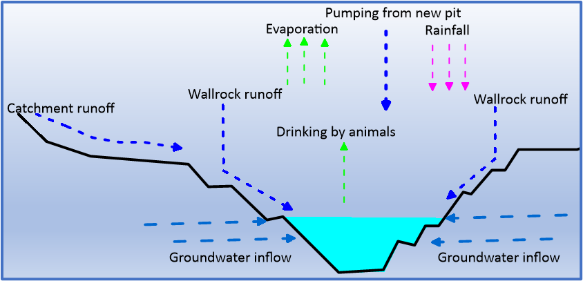
- Develop water balance of the mine pits
- Determine the future status of the pit lakes, including recommendation of the post-mine closure use of the pits
- Determine groundwater flow direction
- Carry out hydrogeochemical assessment to determine groundwater provenance and evolution using major ions
- Establish a Site-Wide Mine Water Balance: In addition to developing water balances for individual mine pits, we conduct a thorough site-wide mine water balance to assess the overall water input, storage, and output across the entire mine site. This comprehensive approach ensures the efficient management of water resources, identifies potential water surplus or deficits, and helps mitigate the risk of adverse environmental impacts on surrounding water bodies and ecosystems
